London, Zürich, Milano
Reportage fotografico di Luigi Fiano
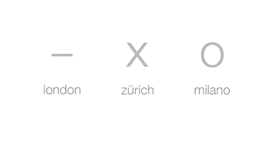
Tre città. Tre diversi percorsi. Una ricerca comune per constatare e sorprendersi di come cambia il paesaggio urbano man mano che ci si allontana dalla ‘City’, cuore pulsante della vita economica e sociale, dirigendosi verso la periferia, passando attraverso quelle zone di confine dove questo passaggio è a volte più evidente e marcato altre meno. Tre città che con la loro conformazione e organizzazione suggeriscono, indirizzano a seguire determinati percorsi lungo delle direttrici ben definite. Così ben definite da poter essere sintetizzate graficamente in tre segni: un tratto orizzontale, una X e una circonferenza.
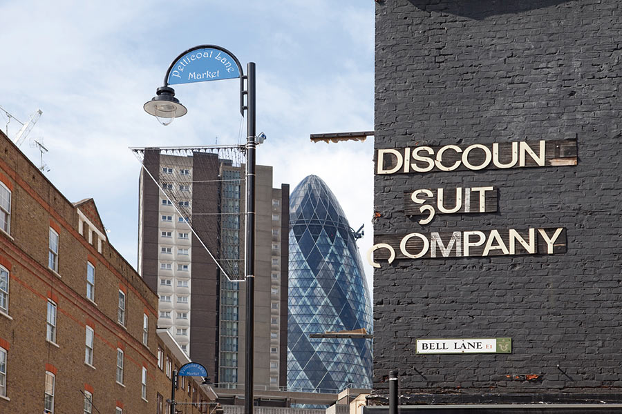
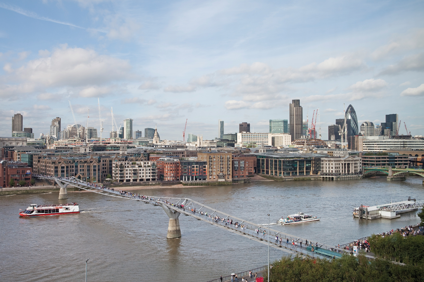
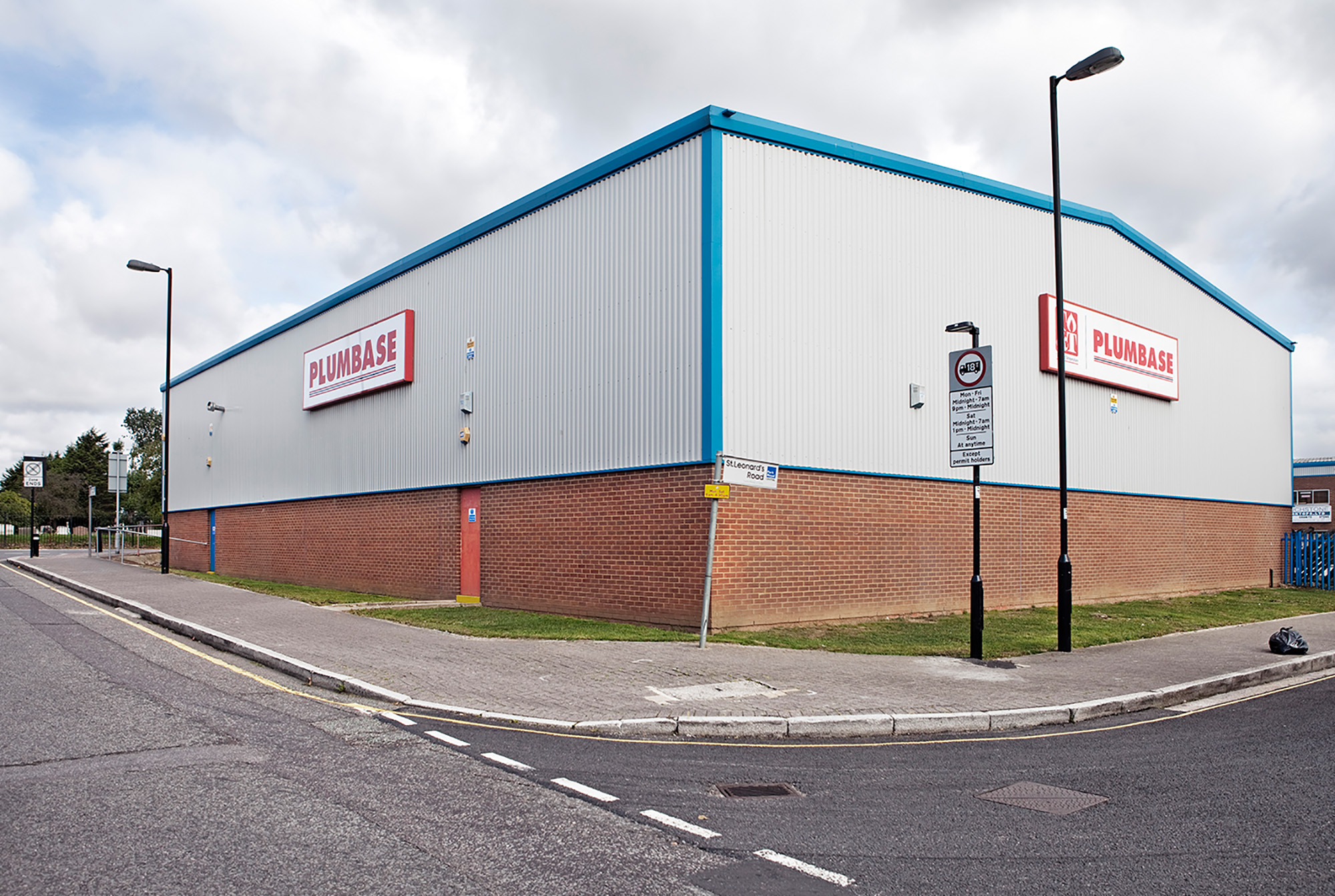
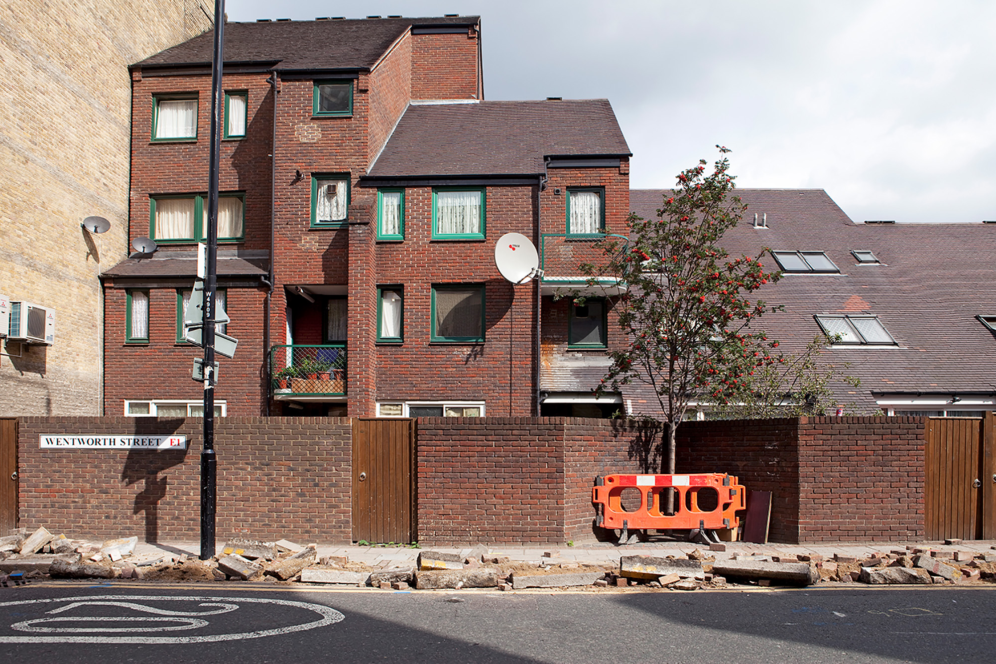
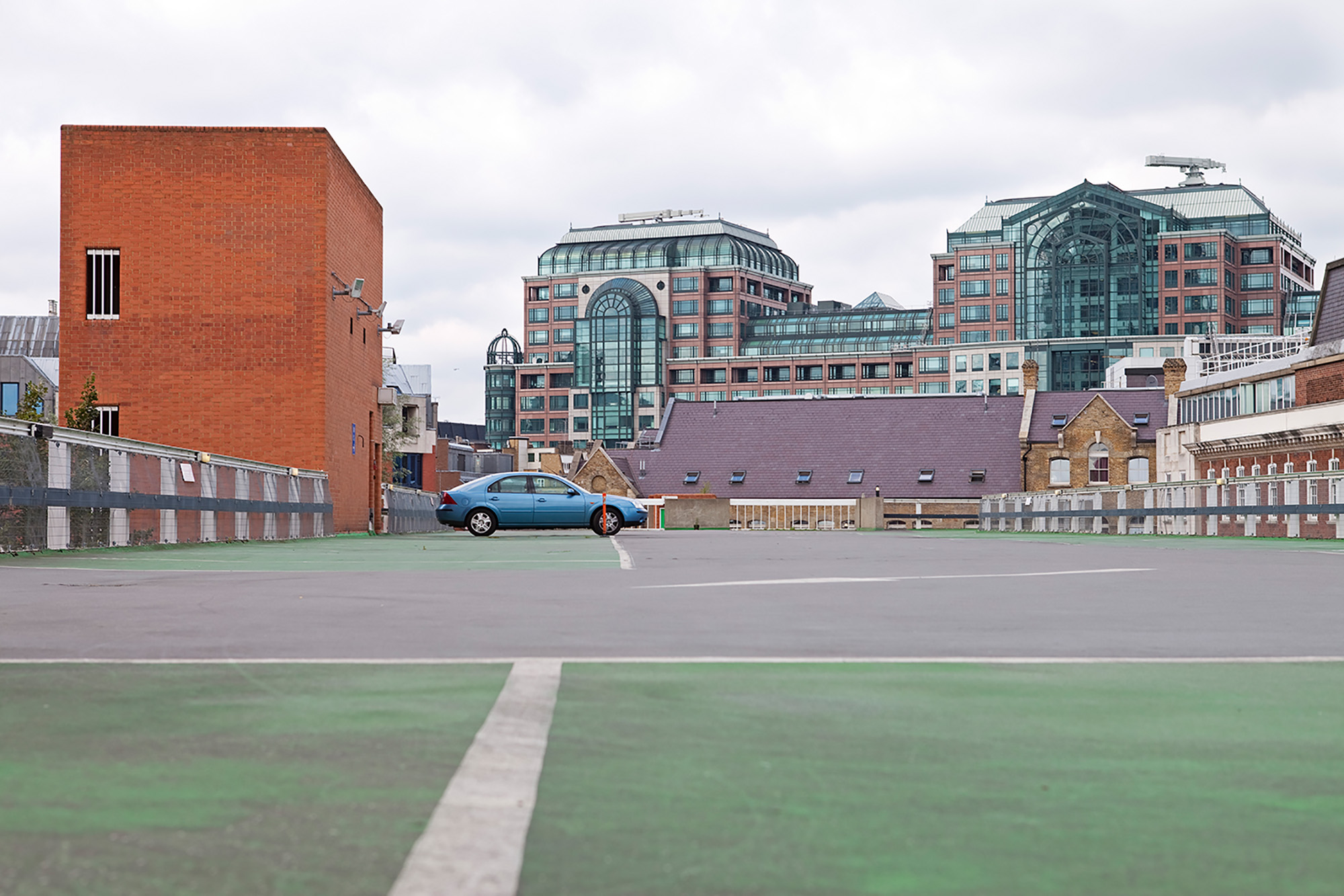
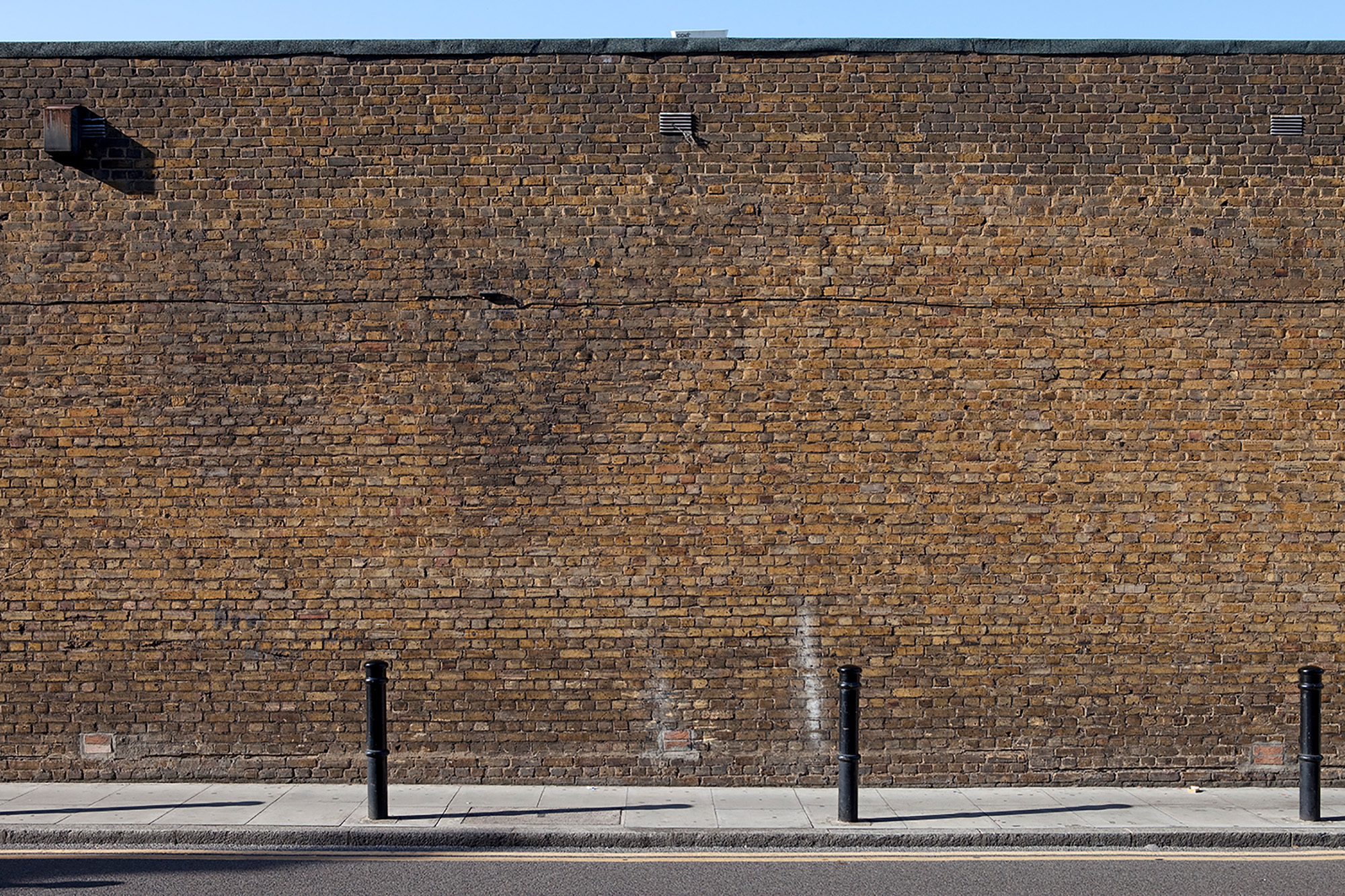
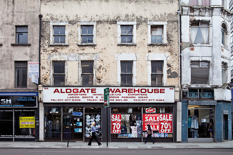
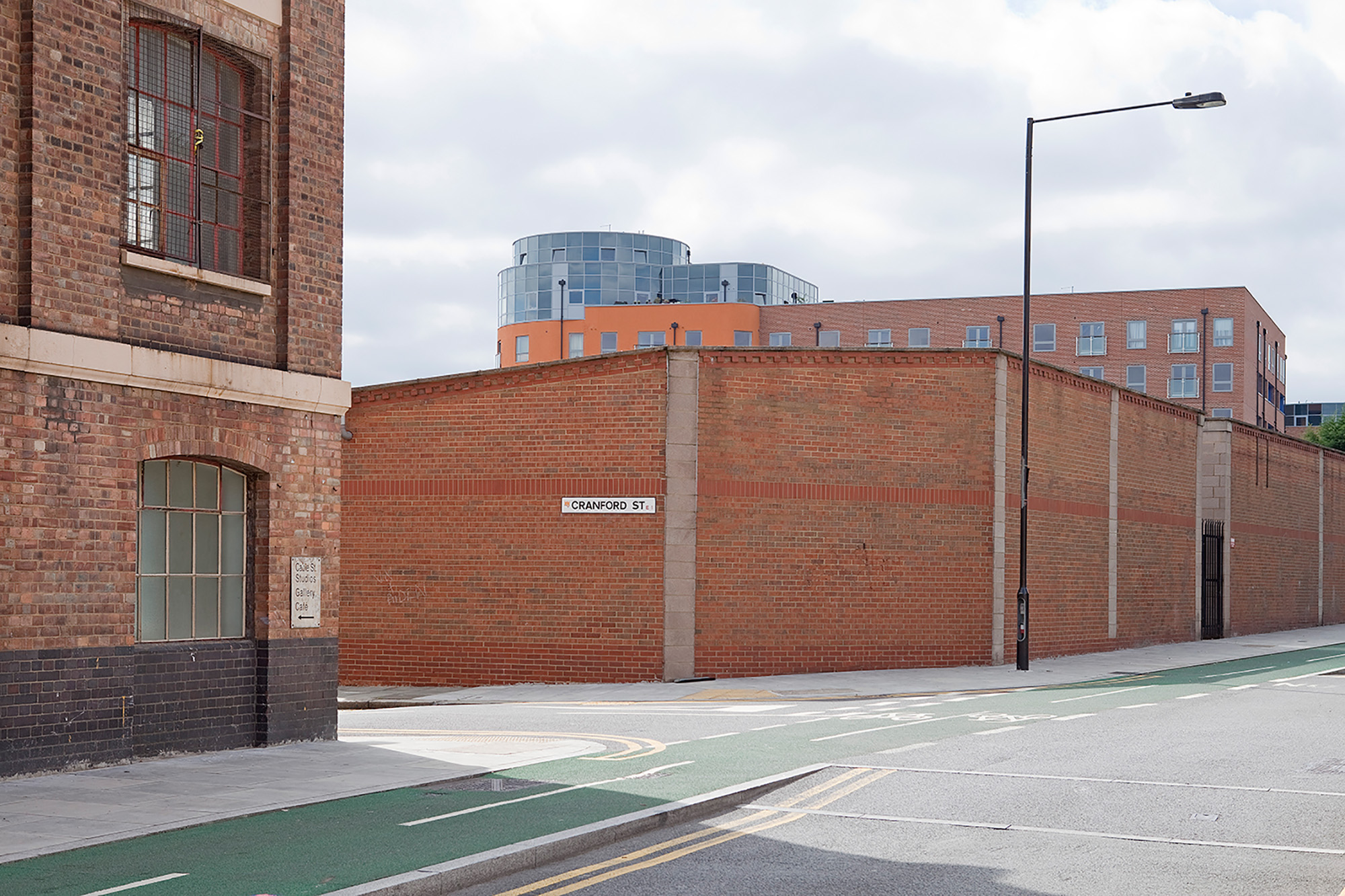
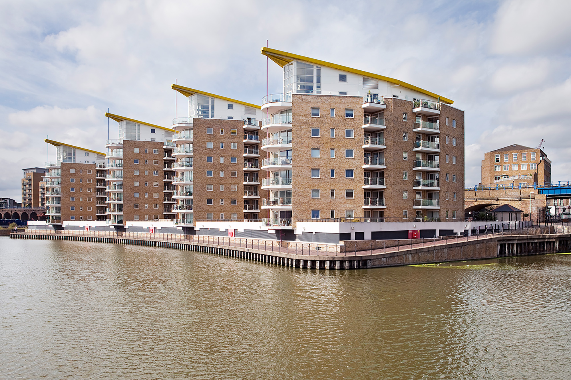
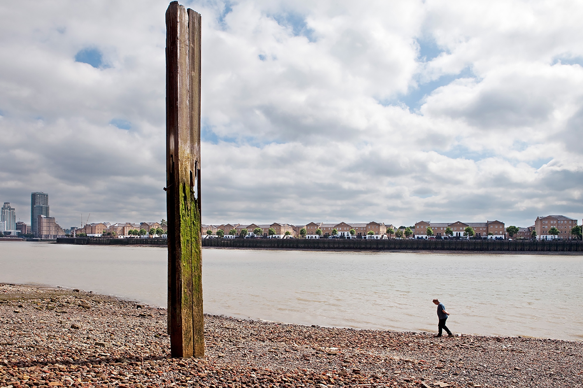
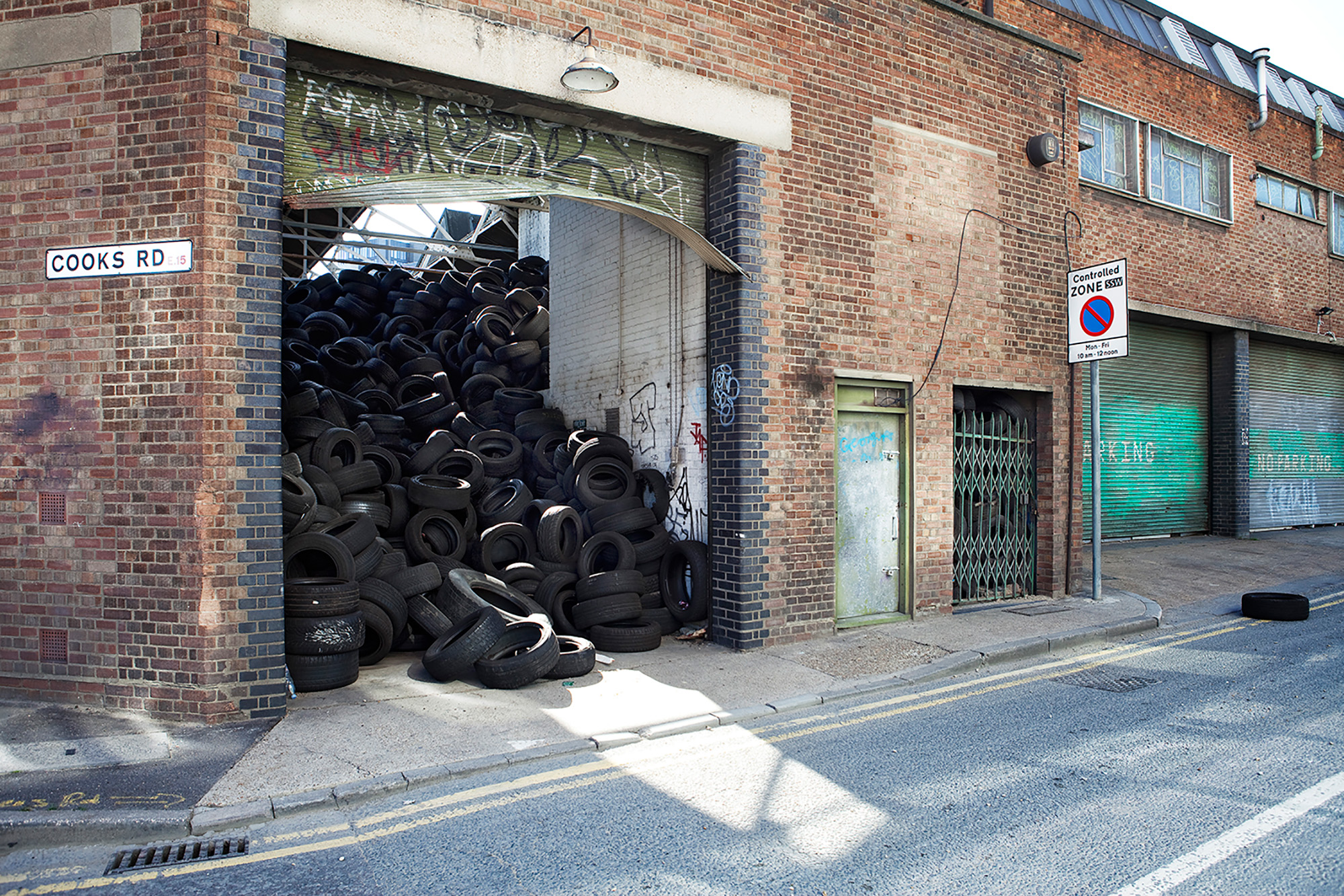
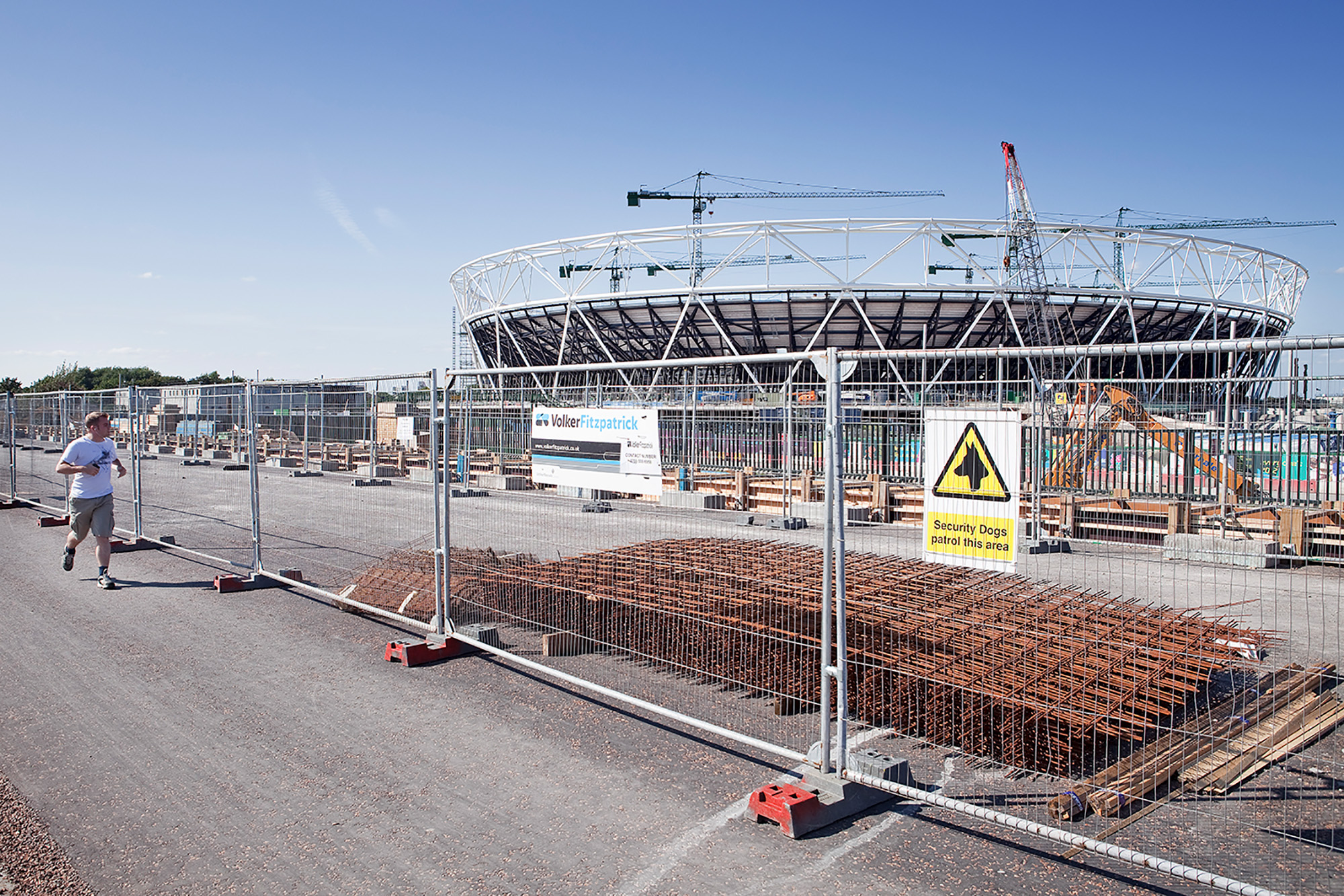
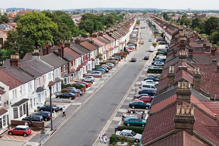
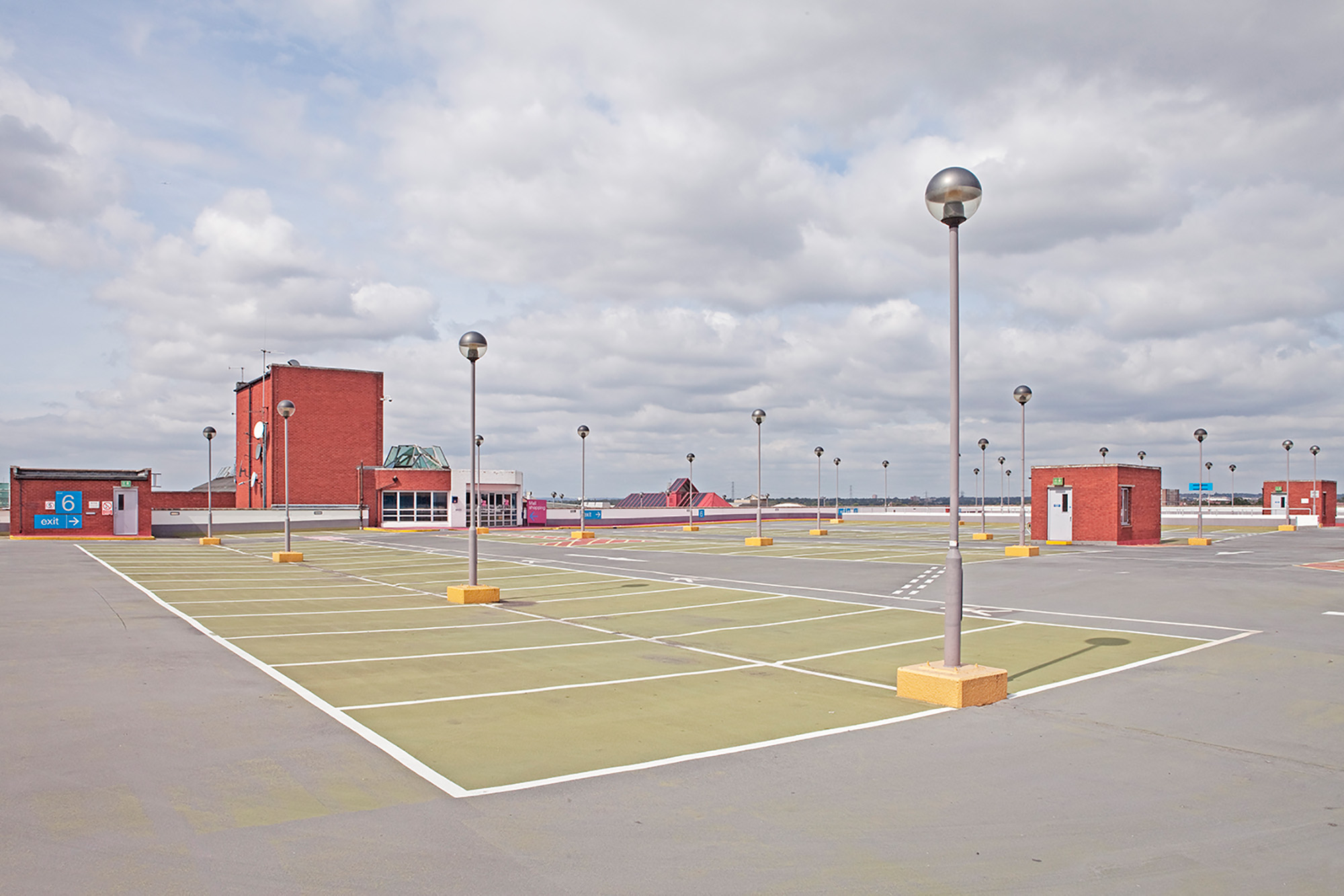
In quest’ottica la città di Londra è assimilabile a un tratto orizzontale. È proprio lungo questa direttrice che si muove il Tamigi in un percorso tortuoso da ovest a est tagliando l’intera città ed è in questa direzione che la ricerca fotografica è stata sviluppata. Partendo dalla zona industriale di West Acton, nella periferia ovest di Londra, passando per la City e i suoi grattacieli, proseguendo per l’East End e le Dockslands fino ad arrivare a Stratford (sede dei cantieri delle prossime Olimpiadi del 2012) e ancora oltre verso Ilford. L’East End è la zona di confine dove è più visibile la sovrapposizione tra vecchio e nuovo, tra la città tecnologica e i suoi grattacieli e le vecchie caratteristiche case di mattoni.
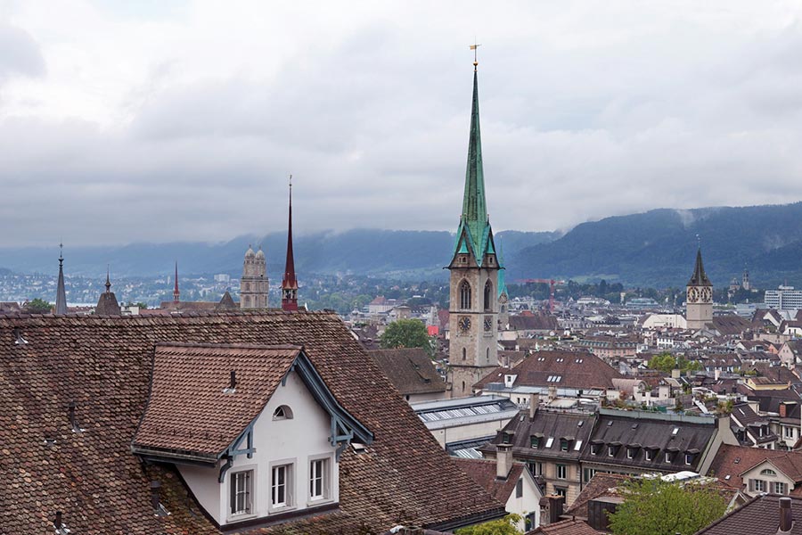
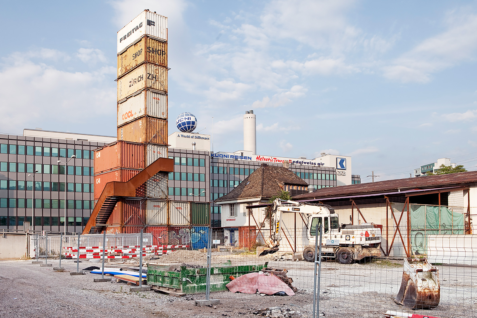
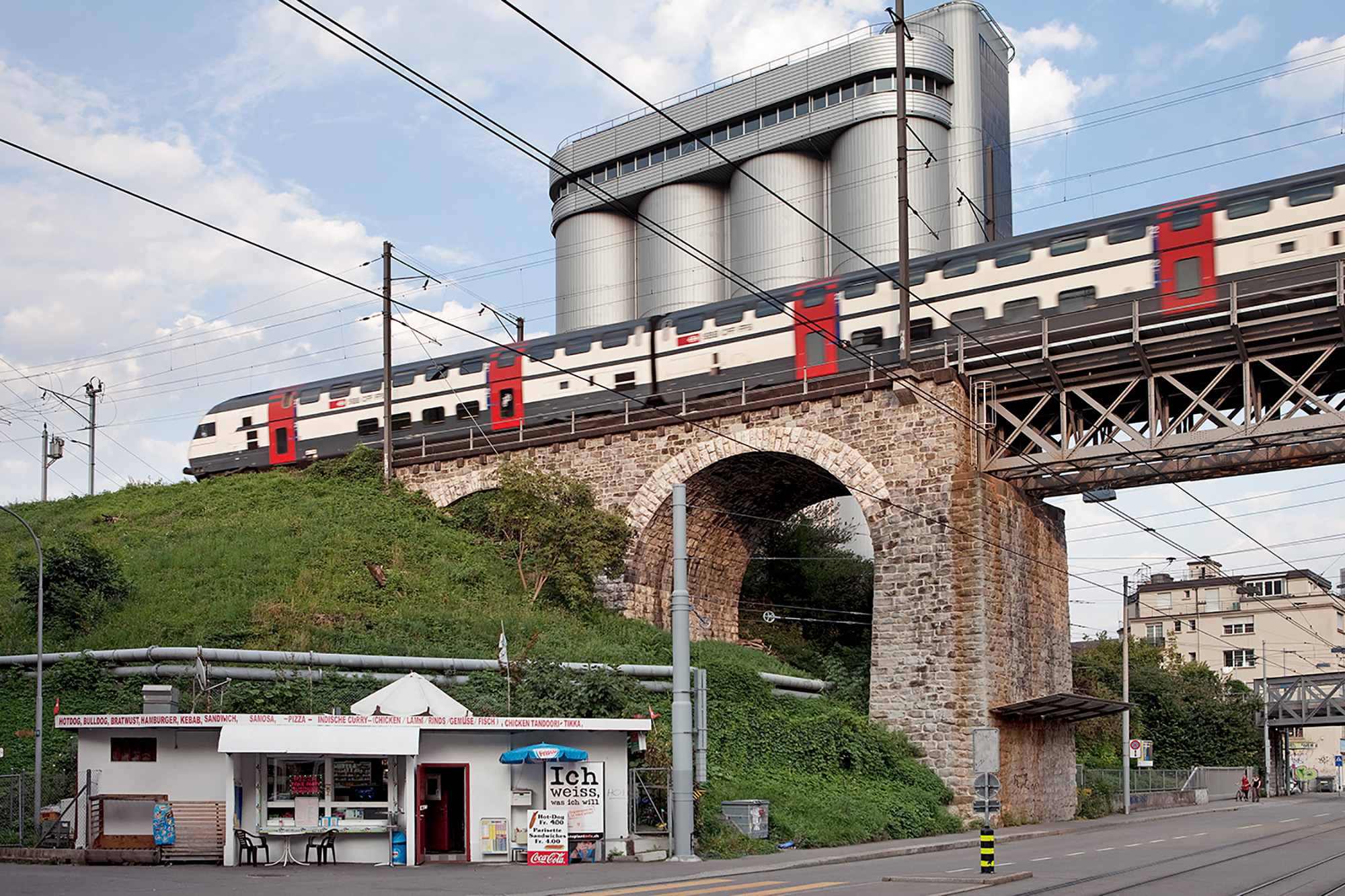
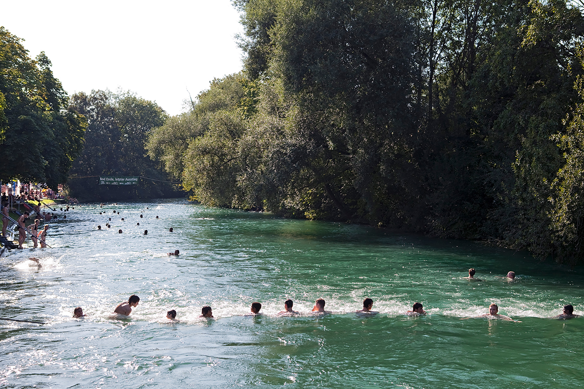
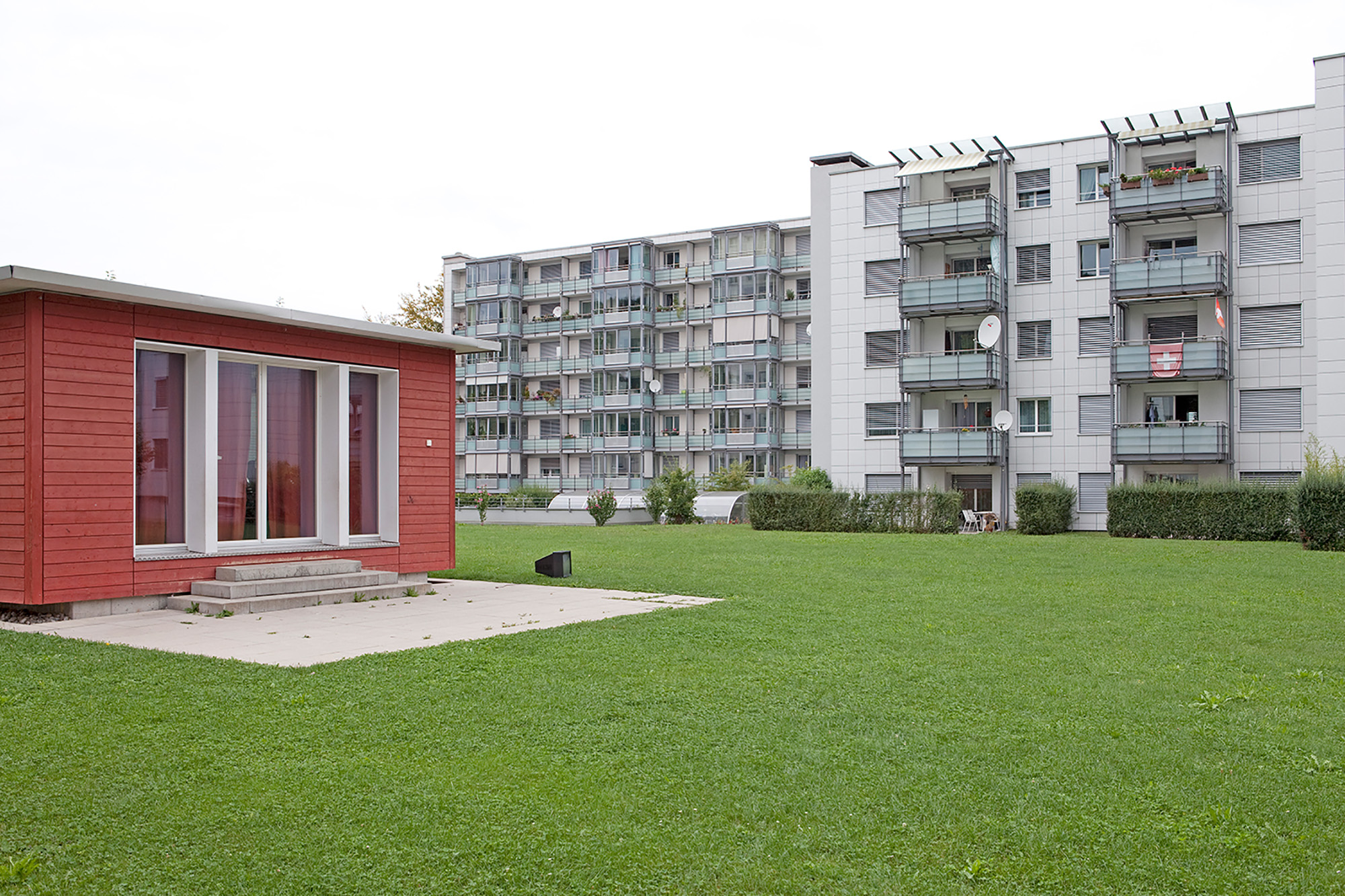
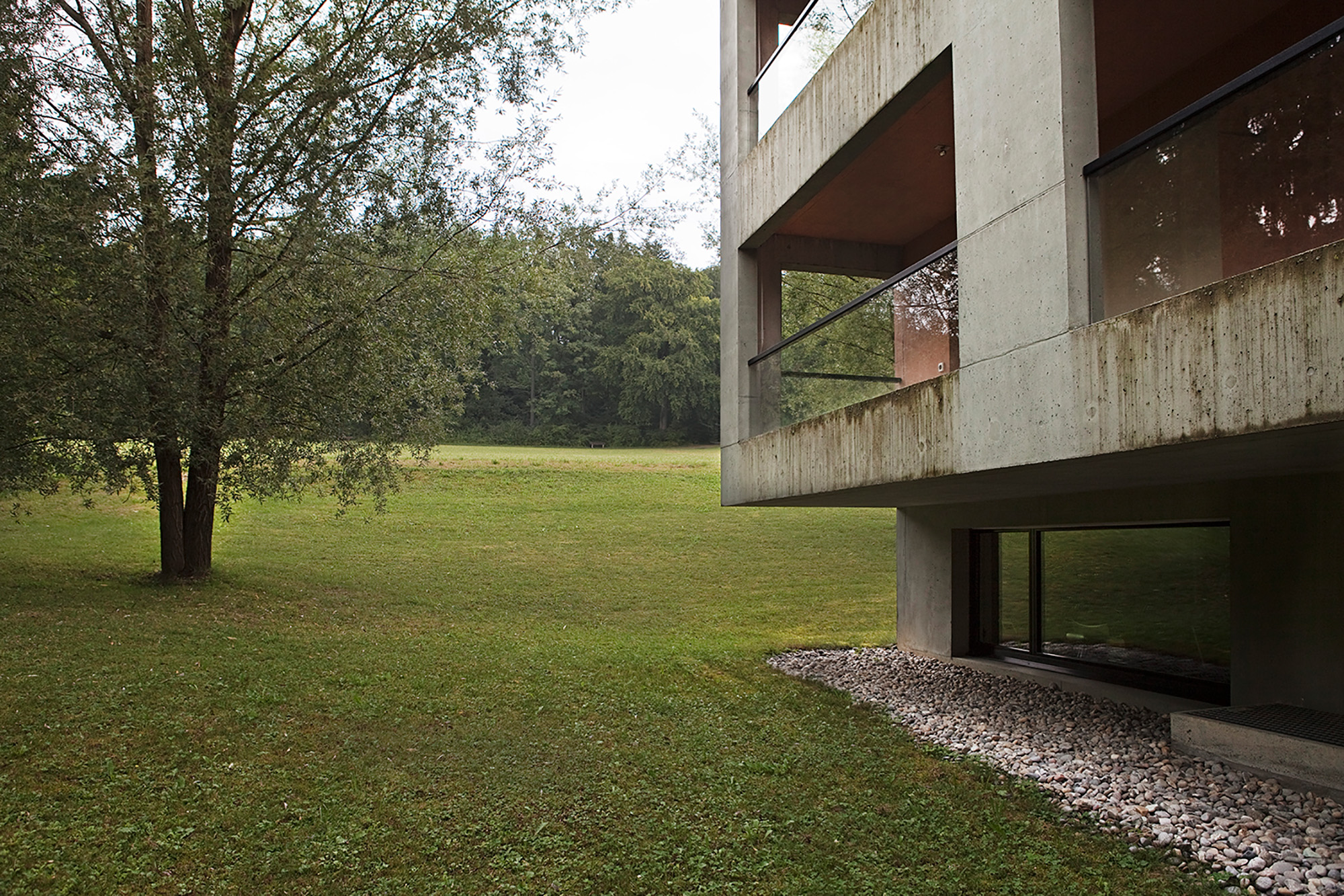
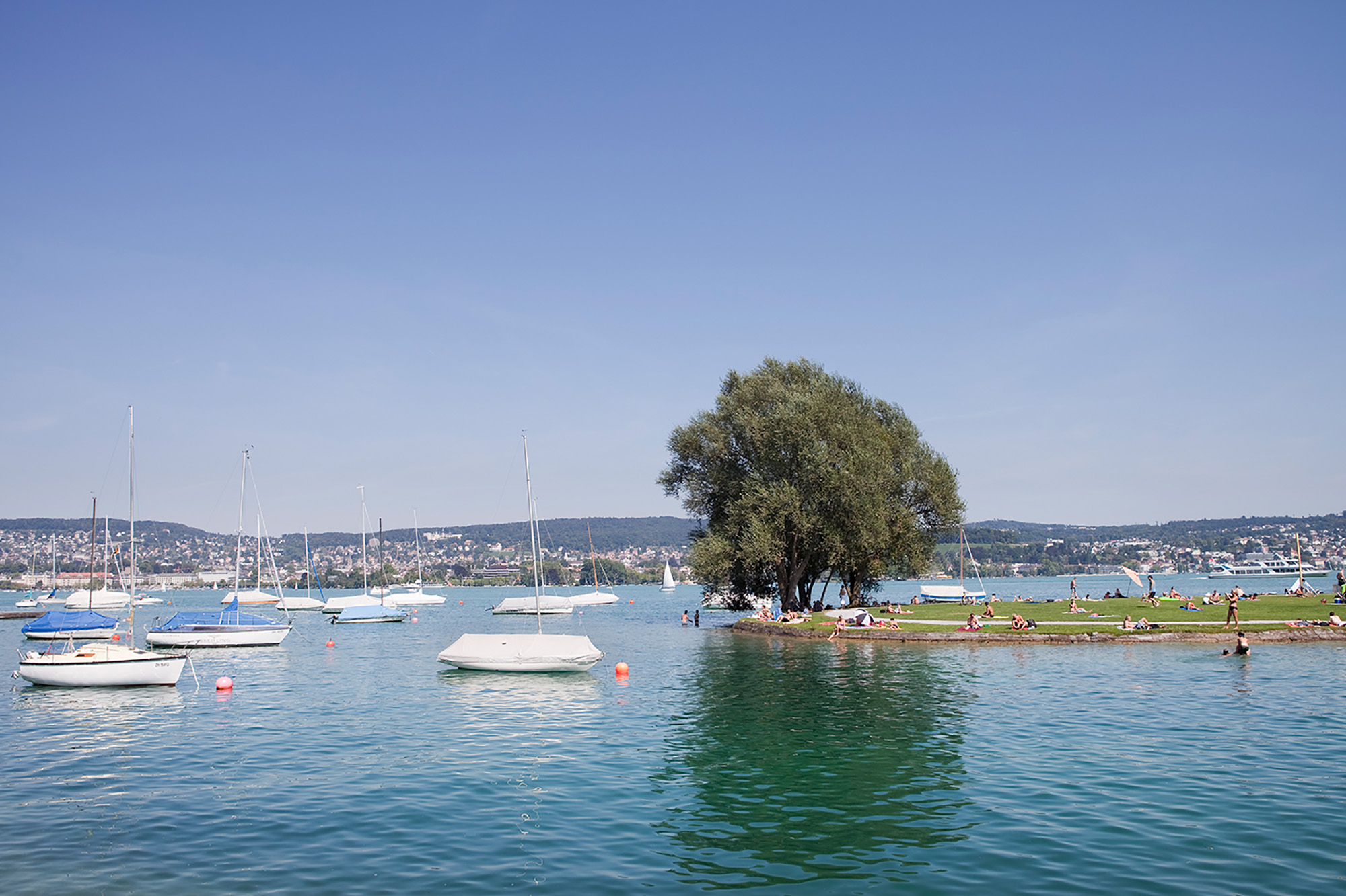
Zurigo vista dall’alto ha la forma di una X. Ogni braccio di questa X ha delle caratteristiche distintive. Il braccio nord-ovest è quello che costeggia la principale ferrovia, una zona che diventa industriale man mano che ci si allontana dal centro. È lungo questo braccio che si estende la Limmatt, il fiume della città. Lungo il braccio nord-est si sviluppa una zona residenziale che diventa più popolare man mano che ci si allontana dal centro, terminando in grandi complessi abitativi. I due bracci meridionali sono separati dallo Zurichsee, il lago di Zurigo. Il braccio sud- est è la zona collinare, per lo più popolata da ville signorili e famiglie benestanti. Il braccio sue-ovest è una zona residenziale adagiata ai piedi della parte più alta della città che supera la quota di 800m. Nonostante i cambiamenti tra queste macro aree siano evidenti, si possono individuare delle zone di passaggio molto più nette e definite. Una di queste è quella di confine tra le zone abitative e i numerosi boschi che popolano Zurigo. Nel cuore della città, nell’arco di pochi metri, il paesaggio muta e l’edilizia residenziale si dilegua lasciando spazio ad ampie distese boschive dove non è difficile vedere cervi e altri animali selvatici muoversi in libertà. Allo stesso modo anche la Limmat e lo Zurichsee rappresentano un importante luogo di confine, non geografico in questo caso ma di passaggio dall’individualità alla socialità ‘allargata’. Fiume e lago, soprattutto nelle giornate di sole, diventano luoghi di raduno, di convivenza sociale, più difficilmente individuabili in altri contesti cittadini.
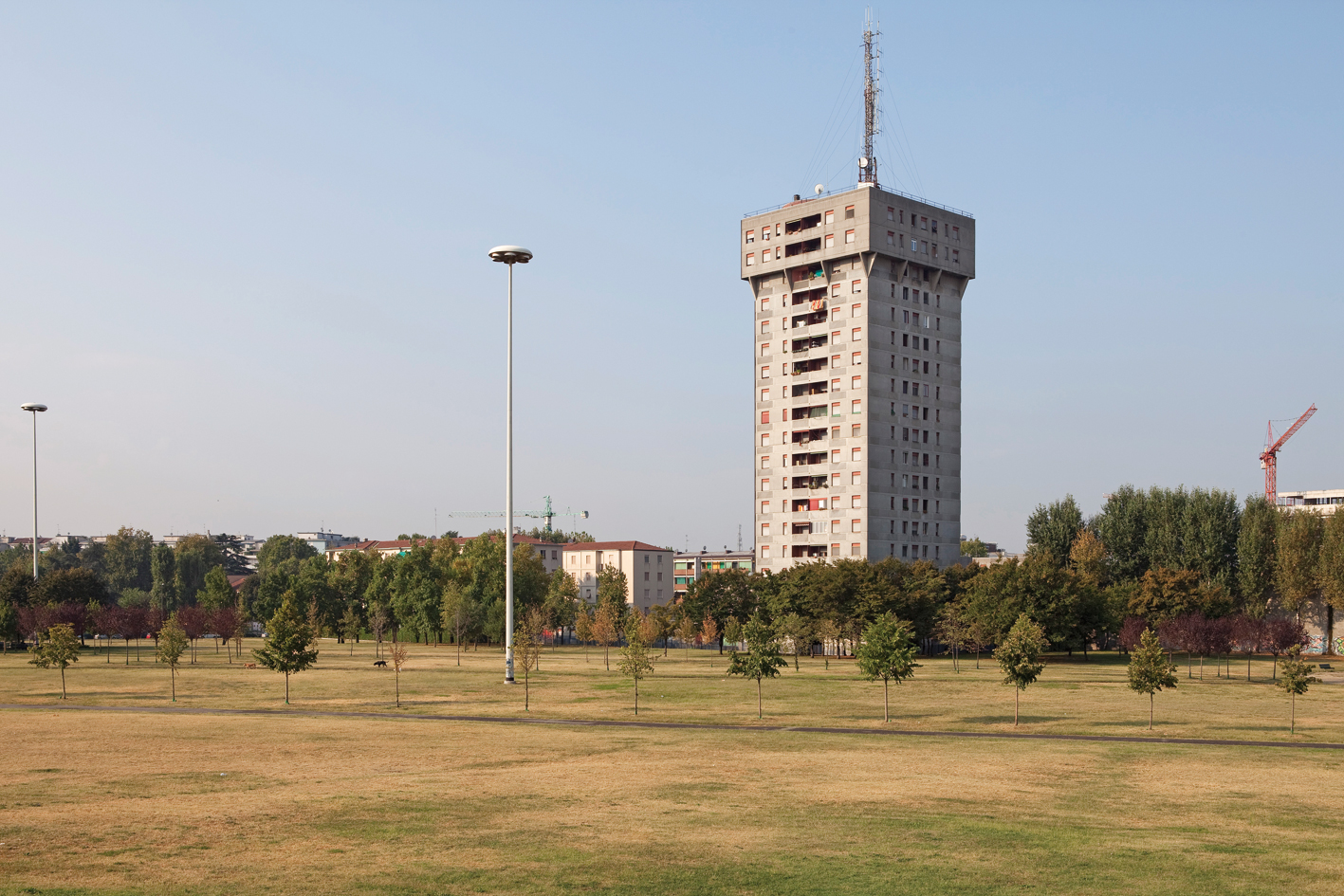
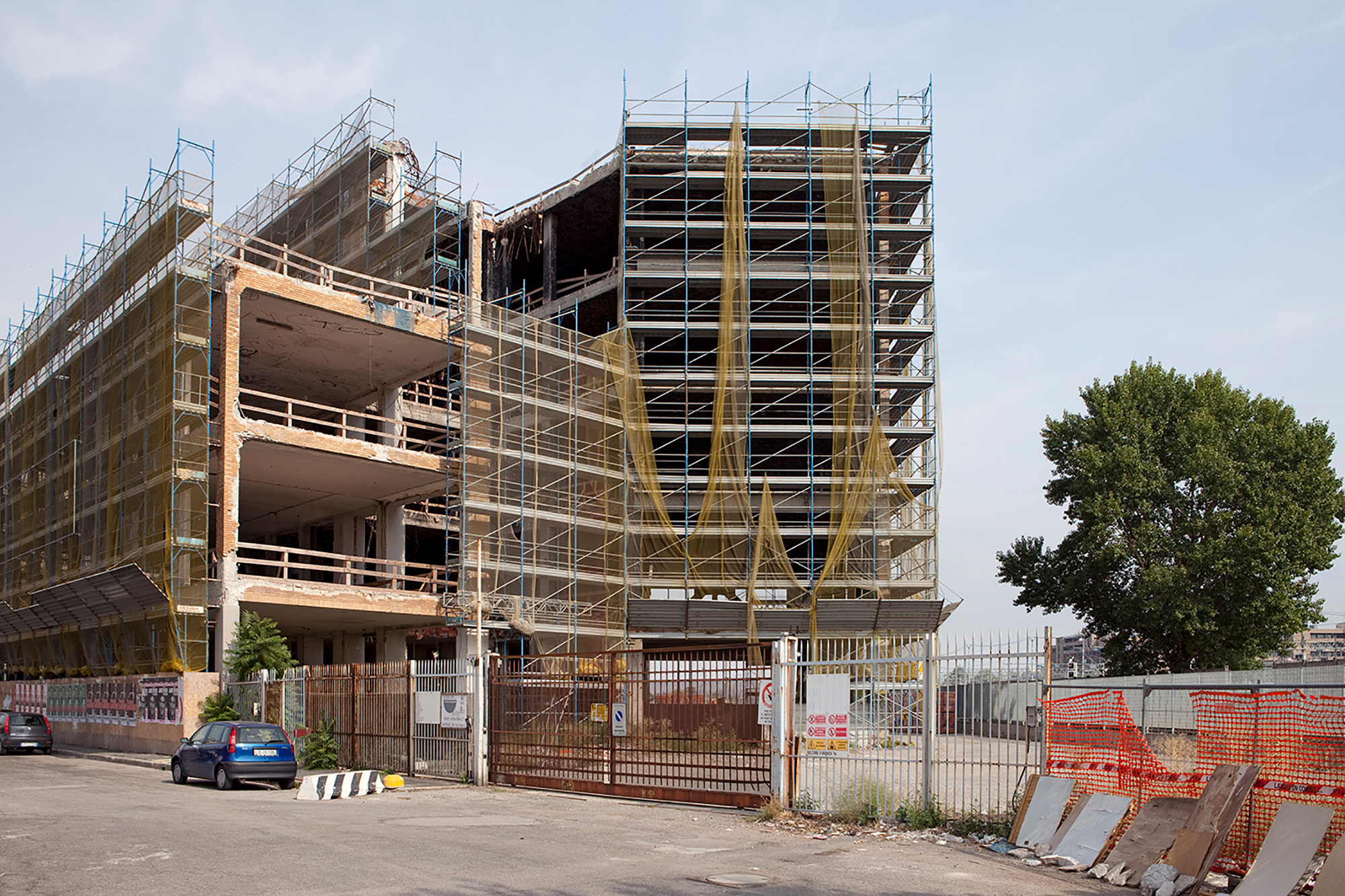
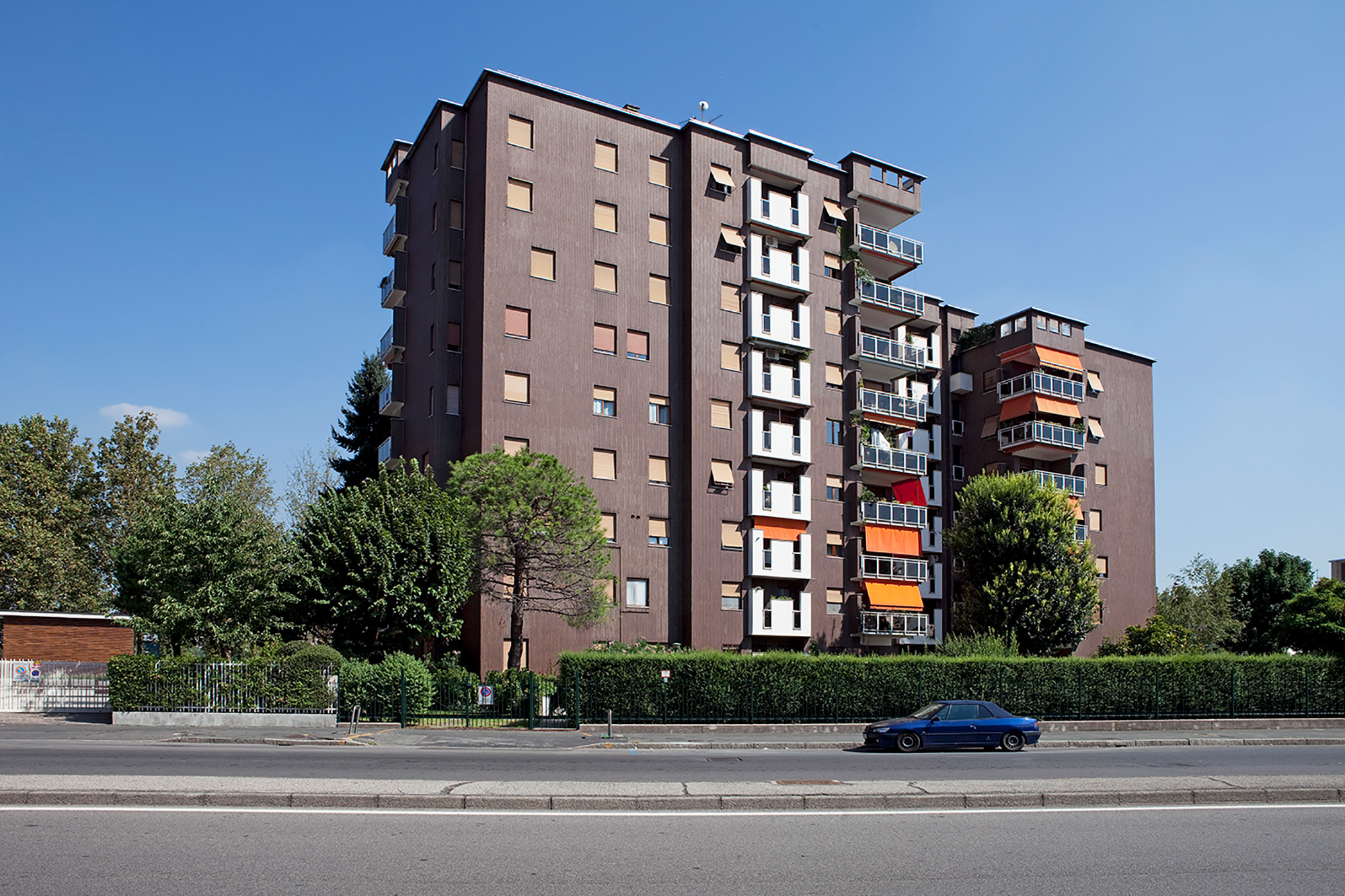
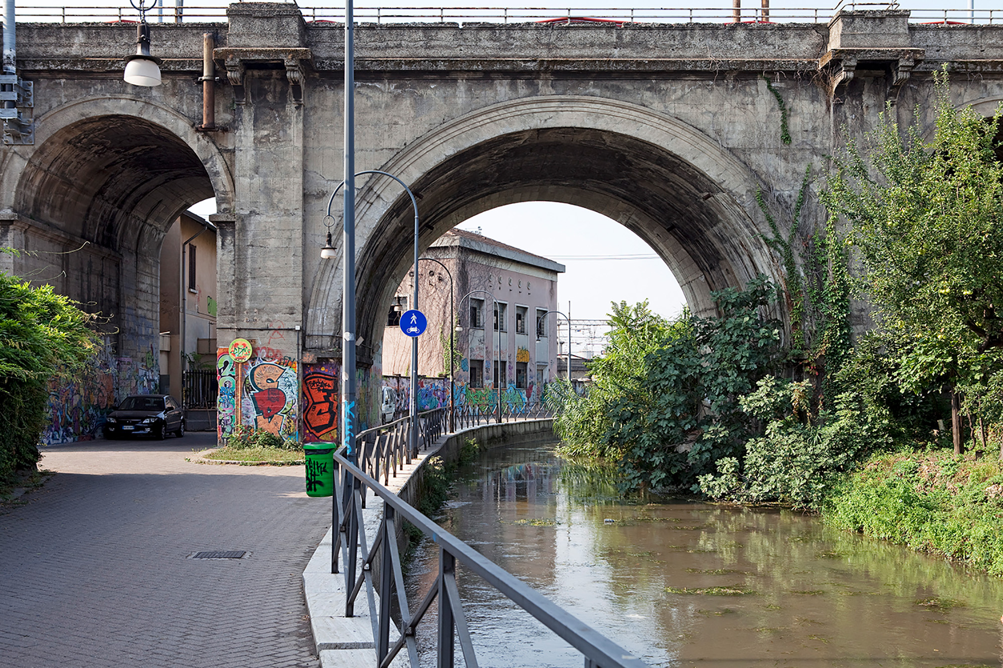
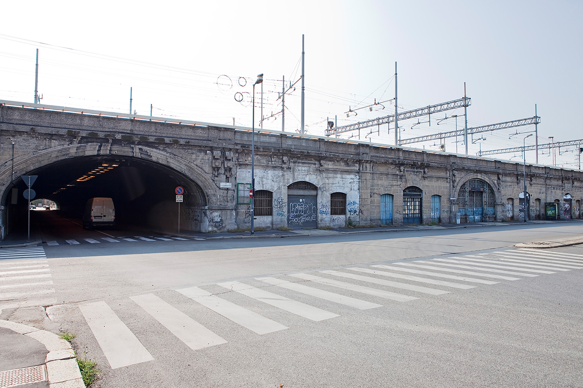
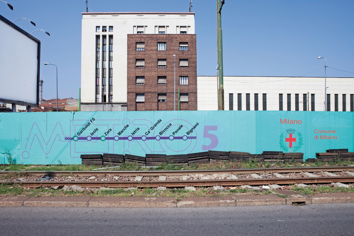
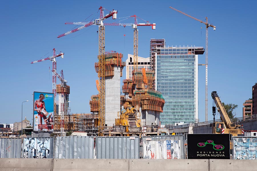
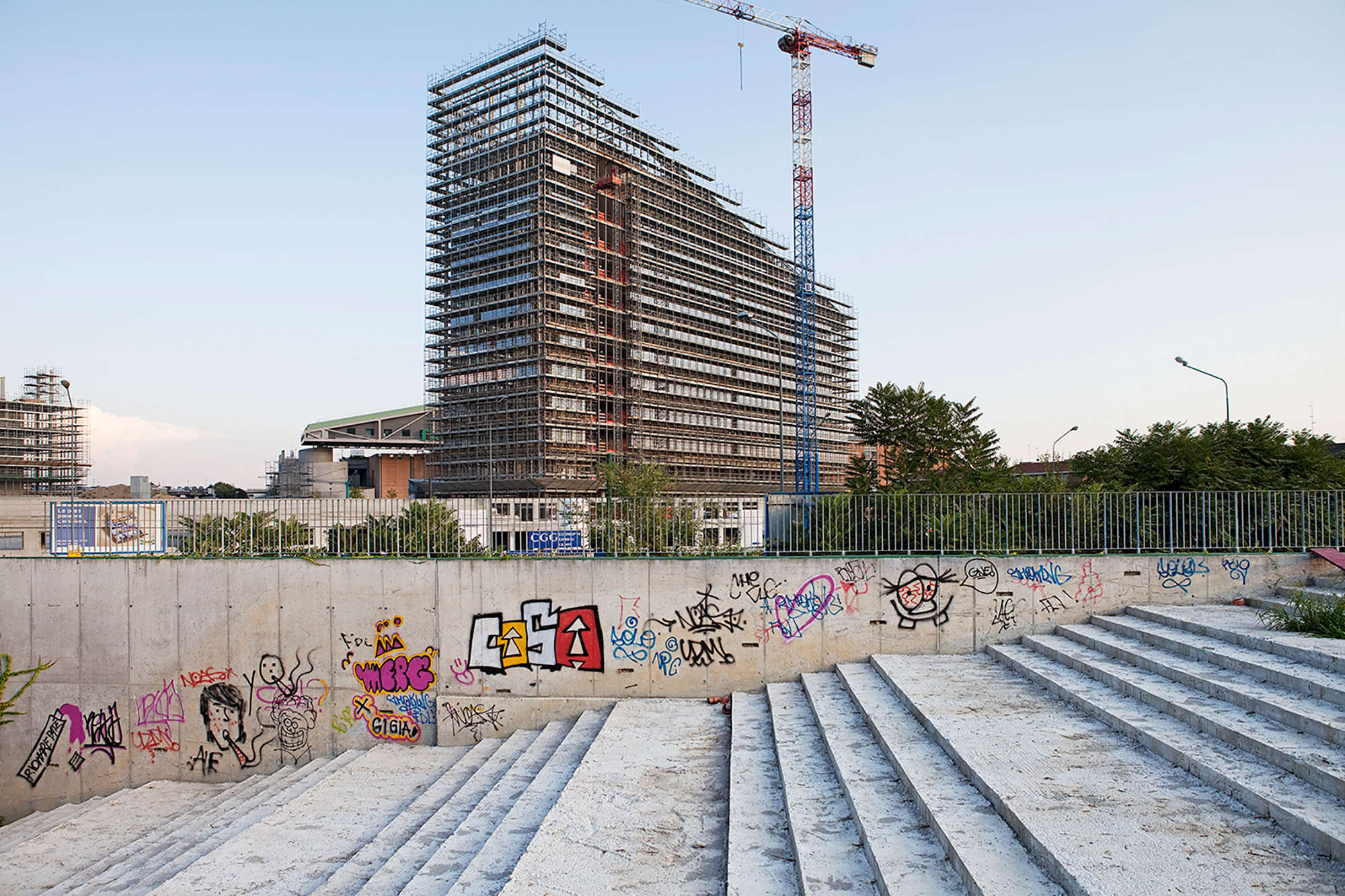
Il segno che più si addice a Milano è senz’altro la circonferenza. Massima semplificazione di quell’insieme di strade che dà vita alla Circonvallazione, una netta zona di confine che divide tutto tra ciò che è dentro e ciò che è al di fuori di essa. Nominata sede del prossimo Expo del 2015, Milano è una città in trasformazione.
Questa ricerca fotografica, lungi dall’essere esaustiva, getta uno sguardo nuovo sulla realtà di tre importanti città europee molto diverse tra loro con lo scopo di voler riaprire una discussione sulla Città e i suoi confini.
[english]
Three cities. Three different itineraries. A common search noticing being surprised at how the urban landscape changes as, little by little we get further away from the ‘City’, pulsating heart of economic and social life, heading towards the suburbs, passing through those areas, borderlands, where this passage is at times more marked, at times less. Three cities whose conformations and organization prompt us to follow given itineraries along well-defined lines. So well defined they are able to be synthesized graphically into three signs: a horizontal stroke, an x and a circumference.
In this perspective, the city of London is comparable to the horizontal stroke. It is along just this line that the Thames follows a tortuous course from west to east cutting through the entire city and it is in this direction that photographic research has been developed. Beginning in the industrial zone of West Acton, in the western suburbs of London, passing through the City and its skyscrapers, going on to the East End and the Docklands and reaching Stratford (site of the next Olympics in 2012) and even beyond, towards Ilford. The East End is the borderland where the superimposition between old and new, between the technological city and its skyscrapers and the old characteristic brick houses is more visible.
Zurich, seen from above has the shape of an X. Each branch of this X has distinctive features. The north-west branch is that which runs alongside the main railway, a zone which becomes more industrial as one gets further away from the centre. It is along this branch that the river Limmatt flows. Along the north-eastern branch a residential area extends which becomes more working class the further away one gets from the centre, terminating in large built up complexes. The two southern branches are separated by the Zurichsee, the city’s lake. The south-eastern branch is the hilly zone, mostly populated by more exclusive villas and wealthier families. The south-western branch is a residential area sitting at the feet of the highest part of the city which is over 800m. Despite the fact that the changes from one macro-area to another are clear, one can still single out zones of passage which are much clearer, more definite. One of these is the borderland between the dwelling areas and the many woods to be found in Zurich. In the heart of the city, in the span of a few metres, the landscape alters and the residential building thins out, leaving space to wide forested stretches where it is not difficult to see deer and other wild animals living in freedom. In the same way the Limmat too and the Zurichsee constitute an important borderland, not geographical in this case but a passage from individuality to a ‘widened sociality’. River and lake, above all on sunny days, become gathering places, social sharing areas, more difficult to single out in other city-dweller contexts.
The sign which most becomes Milan is undoubtedly the circumference. Maximum simplification for the sets of streets which enliven the Circonvallazione, a clear border- land which divides everything between that which is inside and that which is outside. Nominated site for the next Expo in 2015, Milan is a city undergoing transformation.
This photographic research, far from being exhaustive, is a new way of looking at the reality of three important European cities which are very different, one from the other. The objective Is to try to reopen a discussion about the City and its confines.
LONDON


MILANO

ZÜRICH


(Tratto da/ from: Nota Bene. I linguaggi della comunicazione. Cartografie/Cartographys, N. 0 Anno 1, Logo Fausto Lupetti Editore, Milano 2009. ISBN 978-8895962-45-0)